Travel guide to the best day walks in the South Island of New Zealand: trail information; how to get there; what you’ll see and walking tips.
If you’re travelling to New Zealand and want to explore New Zealand’s the South Island’s best day walks without spending the preparation and gear required for overnight tracks, then this guide is for you.
Kia Ora, we’re MoaTrek, and we’ve been running small group tours all over New Zealand since 1971. Our travellers always tell us how much they love getting out and walking in all the places we visit, like Abel Tasman, Mt Cook, Queenstown, Franz Josef Glacier and the West Coast.
So here are our favourite day walks in the South Island, including everything you need to know like walking distances, times, elevations, how to get there & things to you’ll see along the way.
Our favourite day walks in the South Island
- Abel Tasman National Park – Awaroa Inlet to Medlands Beach
- Mount Cook National Park – Kea Point & the Hooker Valley
- Routeburn Track – Routeburn Shelter to Routeburn Falls
- Queenstown – Ben Lomond Track
- Franz Josef Glacier – Franz Josef Valley Walk
- Paparoa National Park – Pororari River Track
- Should I walk independent or guided?
Abel Tasman National Park Day Walk
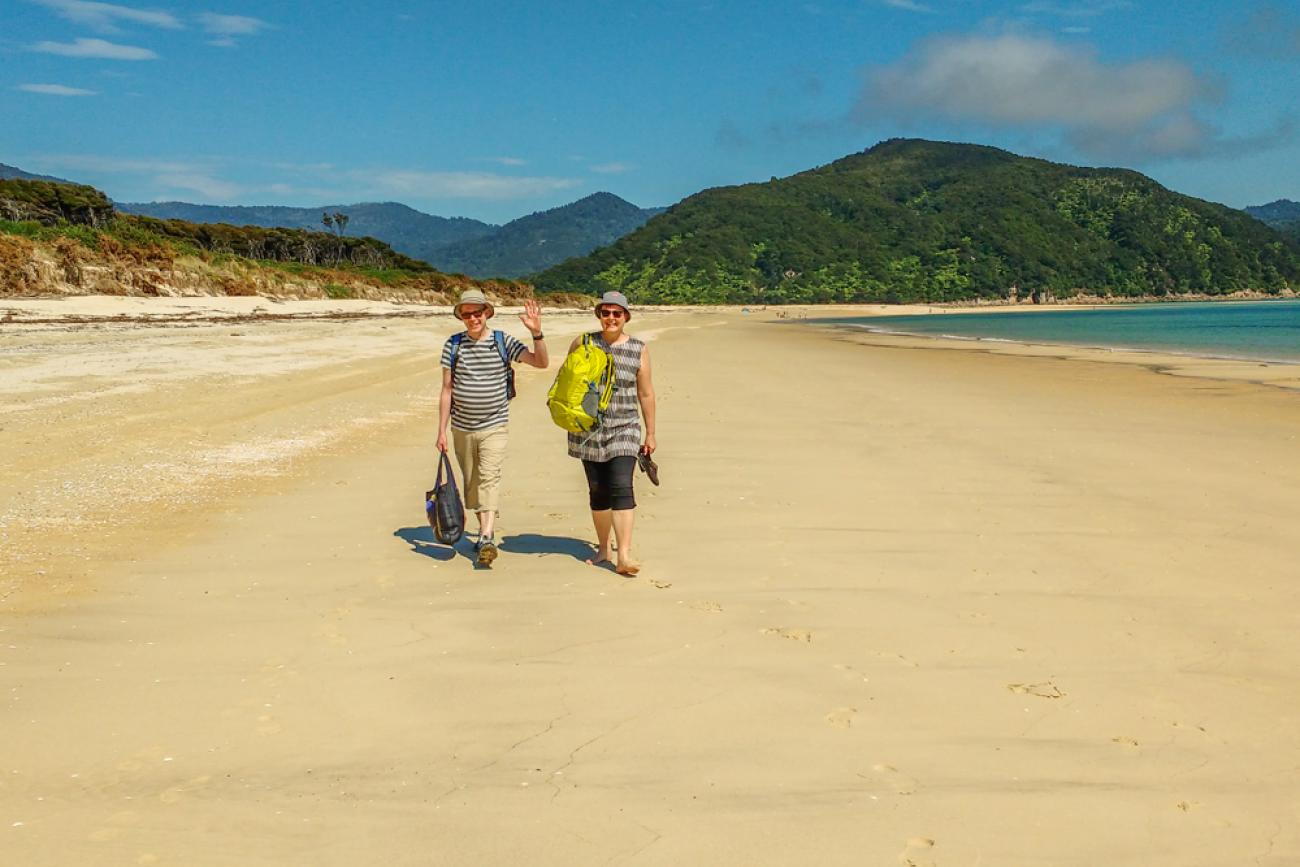
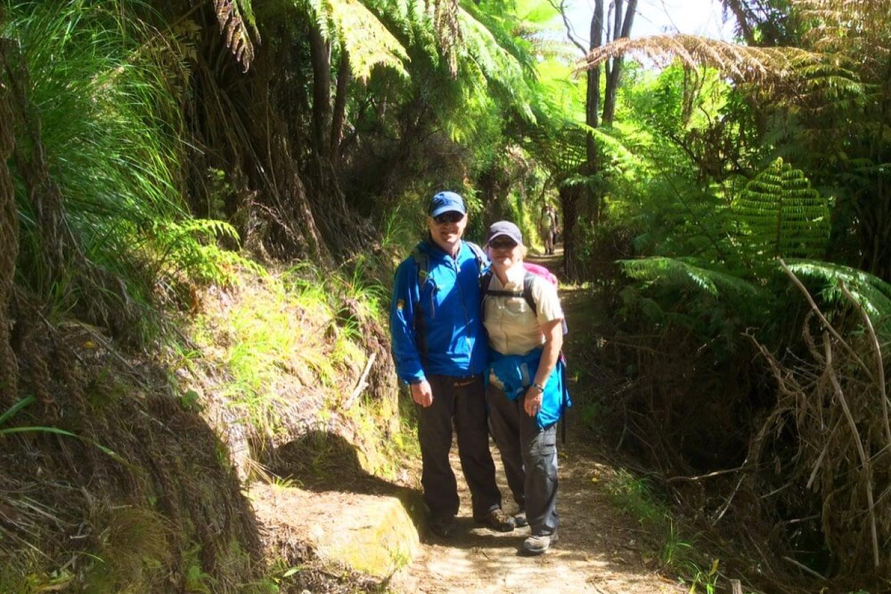
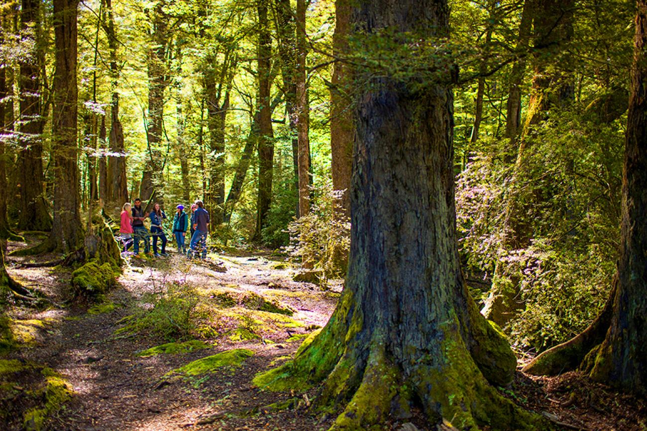
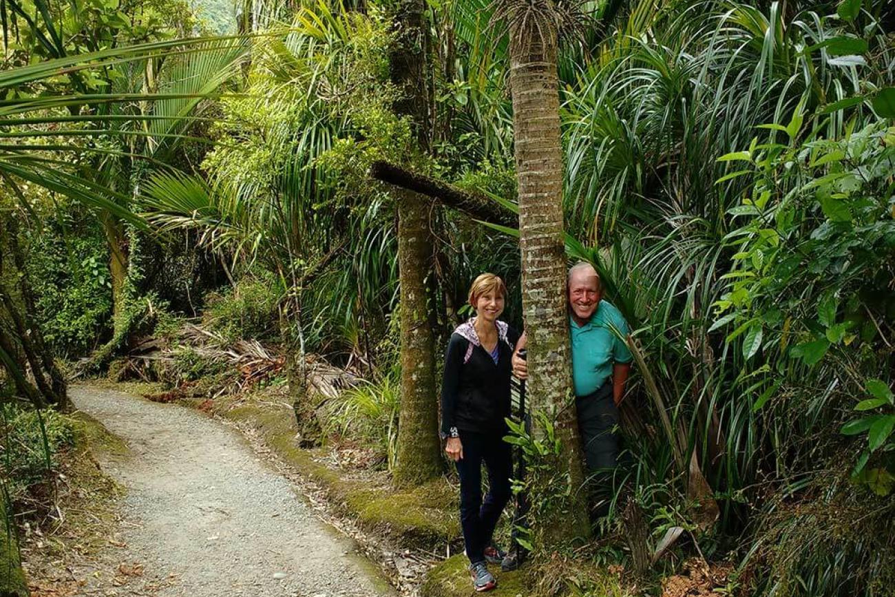
The stunning Abel Tasman National Park at the top of the South Island is an essential destination for any visitor to New Zealand, it captures the very best of what New Zealand has to offer: expansive golden beaches; pretty native bush and abundant native birdlife and wildlife.
The national park is also home to the popular Abel Tasman Coastal Track – one of New Zealand’s Great Walks. Whilst the full 60km/ (37 miles) track takes 3 to 5 days to walk, there are shorter sections of the track which make great day walks.
Our favourite Abel Tasman day walk – Awaroa to Medlands Beach
This 4–5-hour walk is perfect for those who have little walking experience and want to experience everything the Abel Tasman has to offer in a short space of time.
Awaroa is only accessible by boat, meaning you get to cruise through the Tonga Island Marine Reserve and enjoy the spectacular views (and hopefully some sea life!) as you begin your journey.
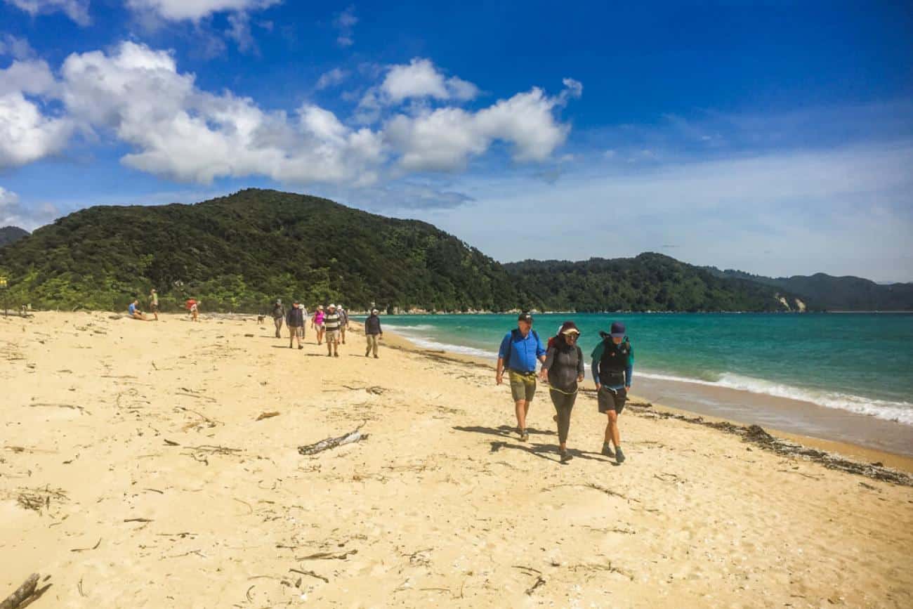
Once on land, follow the signs to join the track and soak in the lovely native bush and birdsong which will eventually lead you out onto the golden sands of Onetahuti Bay.
You will walk the length of Onetahuti Bay, so you need to be mindful of tides. This section of the track is only accessible four hours either side of high tide, otherwise you will be wading through water. Check tide times before you set out and ensure your water taxi bookings allow for this timeframe.
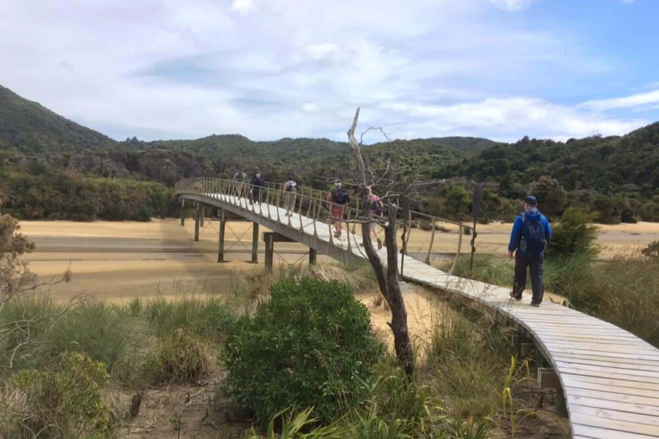
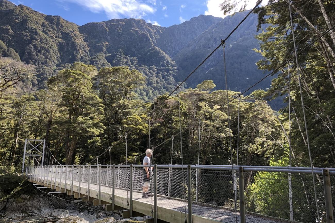
Soon after leaving Onetahuti, you’ll reach Tonga Quarry where you can opt to end your journey. Alternatively, if you’re continuing on to Medlands Beach, you’ll head into the bush again before reaching the picturesque Bark Bay swing bridge and Medlands Beach, where you should have enough time for a paddle in the azure waters of the bay before your water taxi arrives.
Abel Tasman Day Walk – What you need to know:
- Grade: Easy to Intermediate
- Distances & Times:
Awaroa to Medlands Beach: 9 km / 5 miles | 4-5 hrs | 122m elevation - Getting There:
Water taxis depart from Marahau or Kaiteriteri (just over 1 hour from Nelson). You’ll need a water taxi to reach Awaroa and to pick you up again at Medlands Beach. - Facilities:
Toilets at Tonga Quarry, Onetahuti campsite & Medlands Beach. Benches and info panels along the way. - Wildlife:
Look for bellbirds, tui, fantails, robins, and possibly seals, dolphins, or whales. - Flora:
Stroll through native beech forest, with black and hard beech, manuka, kanuka, ferns, and vibrant red-flowering rata.
MoaTrek Travel Tips for walking in Abel Tasman
- Book your return taxi in advance – be clear on pick-up time and location.
- Check tide times for crossing Onetahuti Bay.
- Guided tour? MoaTrek will handle logistics for you.
Mount Cook National Park Day Walks
Kea Point and the Hooker Valley
Located within the spectacular Aoraki/Mount Cook National Park, the Kea Point Track is a pleasant walk with incredible views of the surrounding peaks and the Mueller Glacier moraine wall.
The gently climbing trail winds through subalpine grassland and some spectacular rock formations before arriving at a viewing area affording incredibly close vistas of the Southern Alps towering above the Mueller Glacier Lake.
For a longer walk, the nearby Hooker Valley Track is also well worth a visit, and you can combine it with the Kea Point for an amazing day of walking in Mt Cook.
The Hooker Valley Track is one of the best day walks in Aoraki/Mount Cook (for good reason), this track takes you over three swing bridges into the stunning Hooker Valley with views across Hooker Lake straight up to Aoraki/Mount Cook – New Zealand’s tallest mountain.
With a total combined walking time of 5-6 hours return, these two walks can both be completed within the same day. The shelters, tables and toilets at the start/end point of White Horse Campground makes it a perfect lunch spot in between your walks.
Mt Cook Day Walks – What you need to know
- Grade: Easy to Moderate
Hooker Valley Track is flat and well-formed.
Kea Point Track includes steady elevation but is still easy for most walkers. - Distances & Times:
Hooker Valley Track: 10 km / 6 miles return | ~3-4 hrs
Kea Point Track: 2.8 km / 1.5 miles return | ~1 hr - Elevation:
Hooker Valley: 80m / 260 ft
Kea Point: 180m / 590 ft - Start Point:
Both walks begin at White Horse Hill Campground, just 5 minutes from Aoraki/Mount Cook Village. Plenty of parking available. - Facilities:
Toilets and shelter at the White Horse Hill Campground.
Kea Point: Benches and scenic lookout.
Hooker Valley: One toilet on route, benches and tables at the lake, interpretive signs along the track - Wildlife to Spot:
Look for kea, NZ falcons, paradise shelducks, and native butterflies like the red admiral. You might also see Southern Alps geckos or skinks. - Flora Highlights:
This alpine region bursts with mountain daisies, Mount Cook buttercups (the world’s largest!), snowberries, gentians, and the sharp Spaniard bush. Best viewed in October to December.
Other Mt Cook Day Walks Nearby
Sealy Tarns Track: A steep climb branching from Kea Point, known as the “stairway to heaven” – 5-6 hrs return, 600m / 1970 ft elevation, epic views.
Also check out Red Tarns Track and Tasman Valley Track for more options.
MoaTrek Travel Tips for walking in Aoraki Mount Cook
Check the weather before you walk and make sure you have extra clothing; alpine conditions can change quickly.
Routeburn Track Day Walks from Queenstown
Routeburn Shelter to Routeburn Flats or Routeburn Falls
Spend a day walking the popular Routeburn Track with this enjoyable return walk starting at Routeburn Shelter.
Located just over an hour from Queenstown within Mount Aspiring National Park, this pleasant 5-to-8-hour day walk (depending how far you want to go) promises abundant native New Zealand bush, stunning swing bridges, pretty waterfalls and lots of mountain views.
The beauty of this day walk is you can do as much or as little as you like. Routeburn Shelter to Routeburn Flats is a popular option totalling 15km/9.3mi return.
For more of a challenge and the best views, you can continue on to Routeburn Falls which will add another 5km/3mi to your return trip.
Routeburn Track Day Walks – What you need to know
- Grade: Intermediate/Advanced
- Start Point:
Routeburn Shelter – 75 mins from Queenstown (self-drive or transfers available) - Distances & Times:
Routeburn Flats: 15 km / 9.3 miles return | 4–5 hrs | Elevation: 700m
Routeburn Falls: 19.6 km / 12 miles return | 6–8 hrs | Elevation: 1000m
Walk as much or as little as you like – even a partial walk is rewarding. For a taste, start with the 45-min Routeburn Nature Walk, or stop at Forge Flats for a scenic lunch break, about 40 mins before Routeburn Flats. - Track Facilities:
Toilets, benches, and info panels are located at Routeburn Shelter, Routeburn Flats Hut and Routeburn Falls Hut. - Wildlife to Spot:
Look for kea, rifleman, yellowhead, and paradise shelducks as you walk. - Flora Highlights:
This lush beech forest walk features mosses, ferns, lichen, and the world’s largest fuchsia – the kotukutuku. At Routeburn Falls you’ll see sub alpine vegetation.
Want to do lots of walking in New Zealand?
Walking in New Zealand is one of the most popular activities on our tours. Here’s our handy guide full of travel tips to help you get ready for all the great walks on your trip.
Ben Lomond Track, Queenstown
The Ben Lomond Track in Queenstown is a popular yet challenging day walk that starts from the Queenstown Skyline Gondola.
The well-formed but exposed track leads walkers 1400m / 4600ft above Queenstown for the spectacular, panoramic lake and mountain views that Queenstown is known for.
This sub-alpine walk will take you a full day and requires a good level of fitness and preparation – all of which will be rewarded with the stunning photos you’ll get at the summit.
Ben Lomond Walk – What you need to know
- Grade: Moderate to Advanced.
The track is steep and exposed all the way, especially the final stretch to the summit, which includes rock scrambling. A good fitness level and the right gear is essential. - Distance & Time:
To Ben Lomond Summit: 11 km / 7 miles return | 6–8 hrs | 1438m elevation
To Ben Lomond Saddle: ~6 km / 4 miles return | 3–4 hrs | 1000m elevation - Start Point:
Begin at the Skyline Gondola on Brecon Street (walkable from Queenstown centre). Take the Gondola to the top and look for the signs for Ben Lomond. - Facilities:
No toilets, water, or shelters on track. Toilets available inside the Skyline Gondola terminal. - Wildlife & Flora:
Spot pipits and possibly kea. The track starts in Douglas fir forest, then opens to tussock fields and sub-alpine vegetation.
Shorter Ben Lomond Walking Option:
Hike to Ben Lomond Saddle (2 hrs one way) for rewarding views without the final steep climb.
MoaTrek Travel Tip for walking Ben Lomond in Queenstown
- Avoid walking from May to September – snow makes the trail dangerous without alpine gear.
- Carry plenty of water, food, and layers – weather can change quickly and there are no facilities en route.
- Make sure someone knows where you are and you take a mobile phone you can use in case of emergency.
Franz Josef Glacier Day Walk
The short, spectacular walk up the Franz Josef Glacier Valley is a must do experience for anyone visiting the South Island’s West Coast.
The well-marked, gently uphill track will lead you from the Franz Josef Valley carpark, through lush rainforest with glimpses of the mountain tops, waterfalls and the upper glacier. From the view point you can see the terminal face of the Franz Josef Glacier in the distance.
Below the viewpoint the Waiho River winds its way towards the coast. The river has cut off access up the valley, so it is not possible to go further on foot. As the glacier retreats this is a good location to see the landscape left behind by the ice and understand the natural forces at work.
In recent years, safety concerns around the ever-changing glacier and its surrounding landscape have meant access to the glacier itself is significantly restricted. To access the glacier directly you will need to book a Heli-hike with one of the operators in Franz Josef village.
Franz Josef Glacier Day Walks – What you need to know
- Grade: Easy to Moderate
- Distance:
1.7 km / 1 mile return - Time:
30 mins return - Elevation:
~200m / 660 ft - Start Point:
Franz Josef Glacier Valley Walk carpark (4.5 km / 2.8 miles south of Franz Josef village). Well-signposted. - Facilities:
Toilets and info panels at the carpark and along the track. - Wildlife:
Kea and small native birds may be seen in forested sections. - Flora:
Explore regenerating native bush shaped by the glacier’s retreat.
Other Franz Josef Day Walks Nearby
- Peters Pool Track: 1.1 km / 0.7 miles (25 min return). Flat trail through rainforest to a scenic glacial lake.
- Douglas Walk: 3.9 km / 2.4 miles (1 hour loop). Features rainforest, glacial landscapes, and a suspension bridge.
Want to Walk on the Glacier?
Book a Heli-hike tour from Franz Josef village. Allow 4–5 hours and moderate fitness.
MoaTrek Travel Tip for visiting the Glaciers on the West Coast
Since March 2019 the nearby and equally popular Fox Glacier Valley Walk has been closed indefinitely making Franz Josef the best place for glacier viewing on the West Coast now.
Paparoa National Park – Pororari River Track
Although this area of the South Island’s West Coast is known best for the iconic Punakaiki Pancake Rocks, there are lots of great day walks in the area.
Our favourite day walk in Paparoa National Park is the Pororari River Track, which gives you the choice of a 2-hour stroll or right up to a 6-hour day walk. Either way, you will be rewarded with striking limestone features, pristine rivers and lush West Coast views.
Pororari River Track – What You Need to Know
- Grade: Easy
- Distance:
7 km / 4 miles return - Time:
1.5–2 hours | Elevation: ~30m / 100ft - Start Point:
Pororari River carpark (1 km / 0.6 miles north of the National Park Visitor Centre, opposite Punakaiki Pub) - Facilities:
Toilet at the carpark, seating along the trail. Nearest additional facilities are at the Visitor Centre. - Wildlife & Flora:
Keep an eye out for weka, tomtits, robins, tui, bellbirds, and kereru. Walk through lush West Coast rainforest, with nikau palms, giant ferns, and flowering rata in season.
Longer Day Walks in Paparoa National Park:
- Pororari to Bullock Creek Road: 15 km / 9 miles loop | 5–6 hrs | Easy–Intermediate.
Extends the main track via Inland Pack Track and Bullock Creek Road. - Punakaiki–Pororari Loop: 11 km / 7 miles | 3 hrs.
Combines Inland Pack and Pororari Tracks. Ends on SH6 – transport back may be needed.
MoaTrek Travel Tips for walking in Punakaiki
- Paparoa Visitor Centre – Visit for maps and local info before you begin.
- Don’t forget insect repellent – sandflies are common.
- After your walk, relax with a drink at the Punakaiki Tavern, just across the road!
Walking Independent or Guided
On many of these day walks, you have the choice of either walking by yourself or taking a guided tour. On many walks, the guided tours include transport which you need anyway and if you don’t have your own car you need to book.
Taking a guided tour removes all the hassle of organizing transport and gear, but the real advantage of joining a tour is that you will learn so much about the area and environment. Walking with a local tour guide who grew up in that area means you’ll hear lots of facts and stories which you’d otherwise miss out on.
If you’re travelling alone, joining a tour also means you will meet other travellers to share your walks with.
The choice of whether to walk independently or with a guide is up to you, if you want to make your own schedule and like exploring off trail, then independent is the way for you. But if you’d like someone else to handle all the logistics, learn lots on the way and meet some like-minded travellers then try a guided tour.
Enjoy the best Day Walks in the South Island with MoaTrek
With so many incredible great day walks in the South Island, it can be overwhelming to know where to start and how to fit them all into your itinerary. Find out more about all the great short walks you can enjoy on a MoaTrek tour here.
If you are planning a visit to New Zealand’s South Island, on a MoaTrek tour you’ll enjoy the best day walks, experiences and hospitality that New Zealand has to offer without having to worry about any of the hassle of organizing everything.
At MoaTrek, we’ve been showing visitors around New Zealand since 1971 and our knowledge of and experience on the South Island’s best day walks (not to mention the rest of the country) is second to none!
Find out more about our New Zealand small group tours here, or get in touch now to start planning your New Zealand adventure.
Read more about Walking in New Zealand
Best Day Walks in the North Island
Walking in New Zealand – A Beginner’s Guide